Geospatial
Our services are designed to transform physical data into actionable insights, empowering our partners to make better decisions, smarter investments, and plan for a better future.
Our Expertise
LOCATION INTELLIGENCE FOR DATA-DRIVEN DECISIONS
Leveraging decades of extensive experience in developing geospatial software and solutions for some of the world’s largest organizations, Motivf’s team uses cutting-edge reality capture and analytics integrated with advanced mapping technologies, spatial analysis, and robust data visualization tools. This comprehensive approach delivers streaming insights on the planet and populations, available when, where, and how decisions are made, enhancing decision-making and operational efficiency.
REALITY CAPTURE
Transform physical spaces and locations into precise digital data with cutting-edge reality capture technologies. Capture your assets and information using 3D scanning techniques, ground-penetrating radar, and global positioning system-enabled field data collection capabilities.
HUMAN MOBILITY
Use near real-time data feeds to deliver the best anonymized and aggregated movement data on the market. Analyze data to uncover human movement patterns provides insights into commute times, popular locations, travel behaviors, and to optimally site your facilities and services to best serve your customers.
LOCATION-ENABLED SOLUTIONS
Develop intuitive, informative applications that include interactive maps, showing where you are, where your assets and customers are located, and how everything is tied together through location. Create map-based visual narratives for engagement and understanding.
GEODATA SCIENCE & VISUALIZATION
Leverage data science and geospatial analytics to transform location data into strategic insights. It's not just about plotting points on a map; it's about transforming data into a visual feast that informs, engages, and inspires action.

Our Work
Enterprise GIS Architecture and Platform Modernization, U.S. Federal Department
Motivf developed a to-be enterprise GIS architecture, transforming multiple legacy facility asset management systems to an integrated cloud-native, component-based and containerized GIS platform with modernized user experience (UX) for optimized mission integration and future application development.
Facilities Indoors Mapping, Midwestern U.S. City
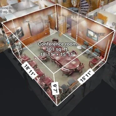
Motivf is performing 3D scanning of over 30 buildings for a City with a population of nearly 200,000, and creating Esri ArcGIS Indoors data as well as immersive 3D virtual reality walk-throughs of the scanned facilties, to support emergency response, asset management, and wayfinding across City-owned facilities.
Underground Utility Mapping and Application Development, U.S. Federal Department
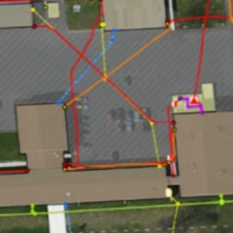
Motivf mapped underground utility assets at multiple government sites and facilities nationwide, performed geodatabase design using industry standards, provided quality control and performance testing, GIS application development, training, and ongoing data maintenance..
Partner with Us
Intersect creatively. Innovate constantly. Pursue extraordinary outcomes.
Join Our Team
Engage fully. Embrace growth. Ignite creative explosions.
Motivf Brand
Humanly crafted, technologically enhanced, and authentically delivered.


